Flying for Science: Kenmore Air and WDFW’s Midwinter Seabird Survey
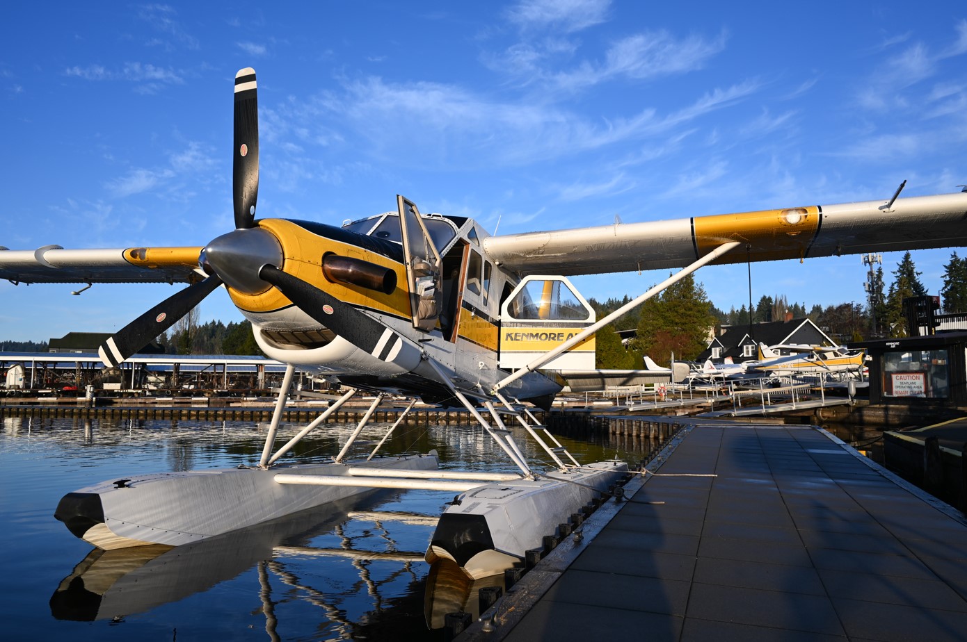
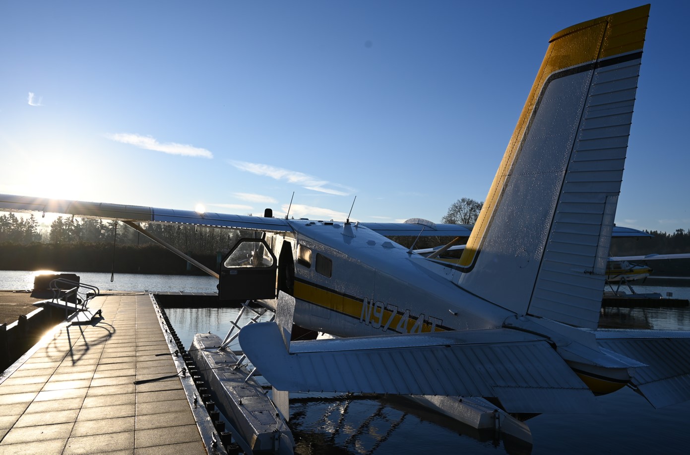
On a series of crisp winter mornings in the Pacific Northwest, when the water is glassy and the shoreline feels almost still, a signature Kenmore Air turbine beaver seaplane lifts off of Lake Washington headed towards the shorelines of Puget Sound. There are no traditional passengers onboard. No phone cameras angled at the skyline. No scenic narration through a headset.
Instead, the mission is scientific.
For decades, Kenmore Air has partnered with the Washington Department of Fish and Wildlife (WDFW) to support the Midwinter Aerial Seabird Survey, a critical, long-running effort to monitor the health, abundance and distribution of marine birds across Washington’s Salish Sea. This work plays an essential role in how Washington manages and protects its inland marine waters.
This past winter, Kenmore Air once again took to the skies alongside WDFW biologists, this time helping advance a new, more precise approach to seabird monitoring that blends aviation expertise with cutting-edge technology.
A Survey Rooted in Place and Time
Washington’s midwinter seabird surveys date back to the early 1990s. Designed to capture a snapshot of marine bird populations during the heart of winter, the surveys focus on a critical window when sea ducks and other marine birds are least likely to be migrating. “Seabirds” refers to several bird groups that depend on the marine environment for some part of their annual life cycle, including ducks, geese, grebes, loons, murres, and more.
WDFW and Kenmore Air conduct these surveys in the winter because this is when the Salish Sea tells its most honest story. During these months, birds settle into predictable patterns tied to food availability, water depth, and habitat. By surveying consistently at the same time each year, biologists can track long-term trends, spotting population changes, identifying areas of concern, and informing wildlife management decisions that ripple far beyond the water’s surface.
The survey is flown along nearly 3,800 kilometers of transect routes, distributed throughout Washington’s Salish Sea waters to systematically sample nearshore and offshore habitats. It’s an ambitious undertaking, one that requires precision (flying at 860 feet and a ground speed of 105 knots), consistency, and a deep familiarity with the region’s complex terrain. That’s where WDFW’s partnership with Kenmore Air comes in.
Why Aviation Matters in Wildlife Science
Counting seabirds from the air is not simply about flying low and looking out the window.
Historically, the surveys relied on experienced biologists visually identifying and counting birds from both sides of an aircraft flying approximately 200 feet above the water at 85–90 knots. Each observer focused on a defined strip of water along their side of the plane, calling out sightings in real time.
It’s a demanding process, and one that requires steady flight, excellent visibility, and close coordination between pilots and biologists. Winter conditions add another layer of complexity thanks to shorter daylight hours and shifting weather systems.
Kenmore Air makes this work possible by providing aircraft, pilots, and operational support capable of flying safely and consistently even in difficult conditions. Meanwhile, skilled WDFW biologists use their expertise in wildlife surveying and species identification to collect data during the flights.
This winter, the survey took an important step forward.
A New Chapter: Digital Aerial Surveys
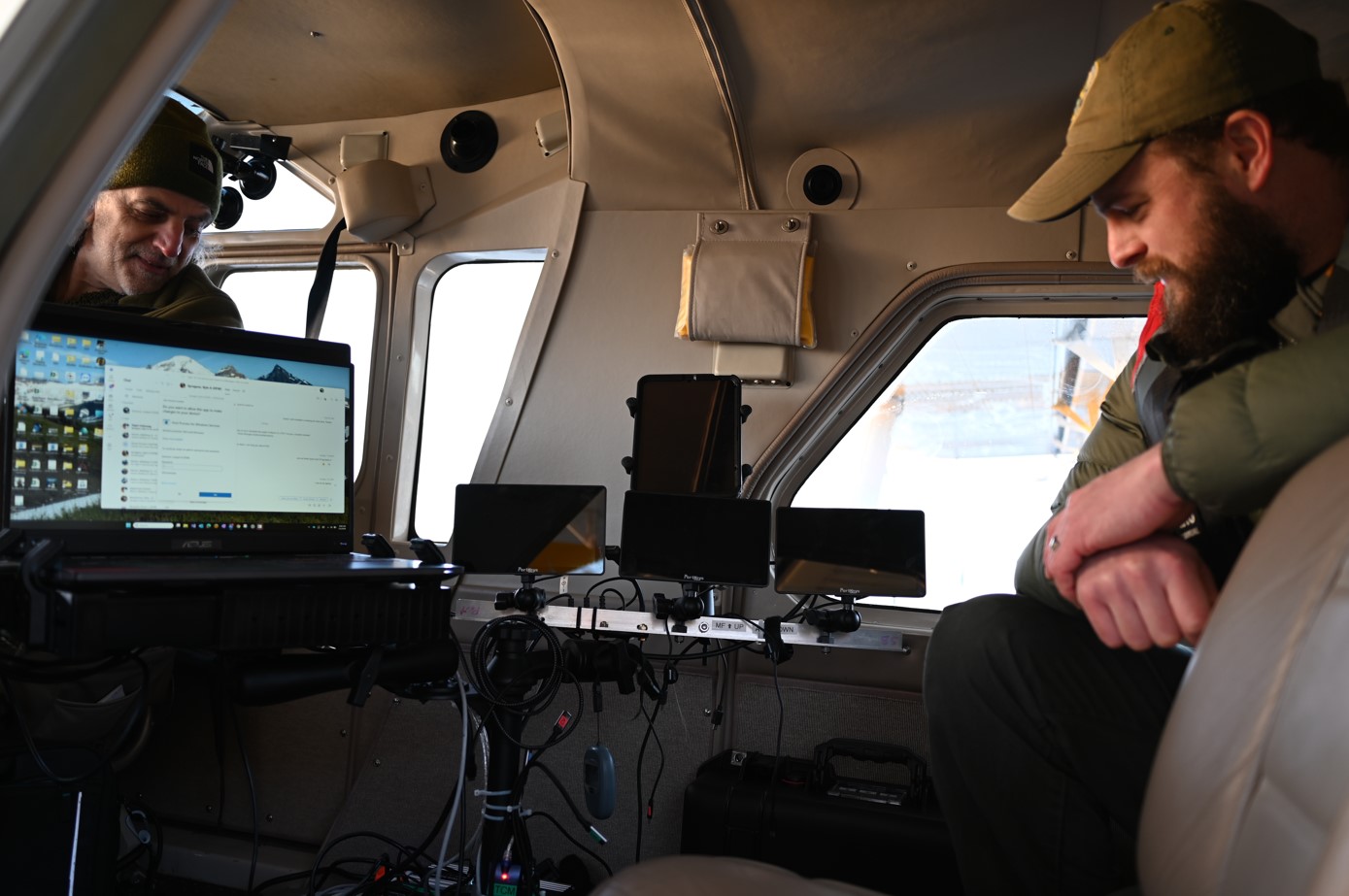
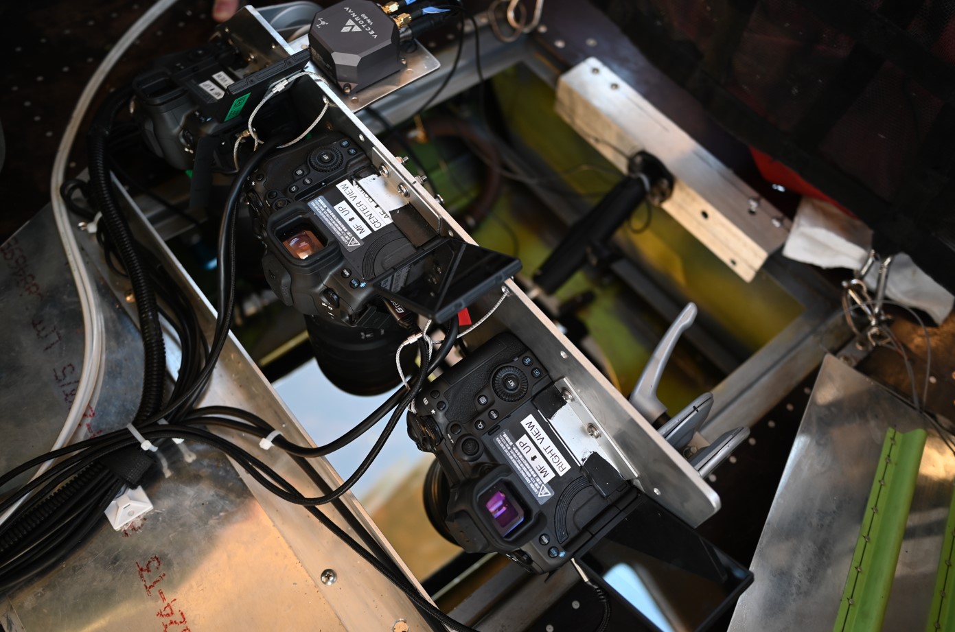
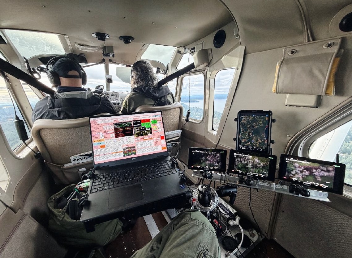
In partnership with WDFW and the Puget Sound Ecosystem Monitoring Program (PSEMP), Kenmore Air supported the deployment of a Digital Aerial Survey (DAS) system, an approach that uses high-resolution imaging, GPS-linked data capture, and machine learning to enhance how seabirds are documented and analyzed.
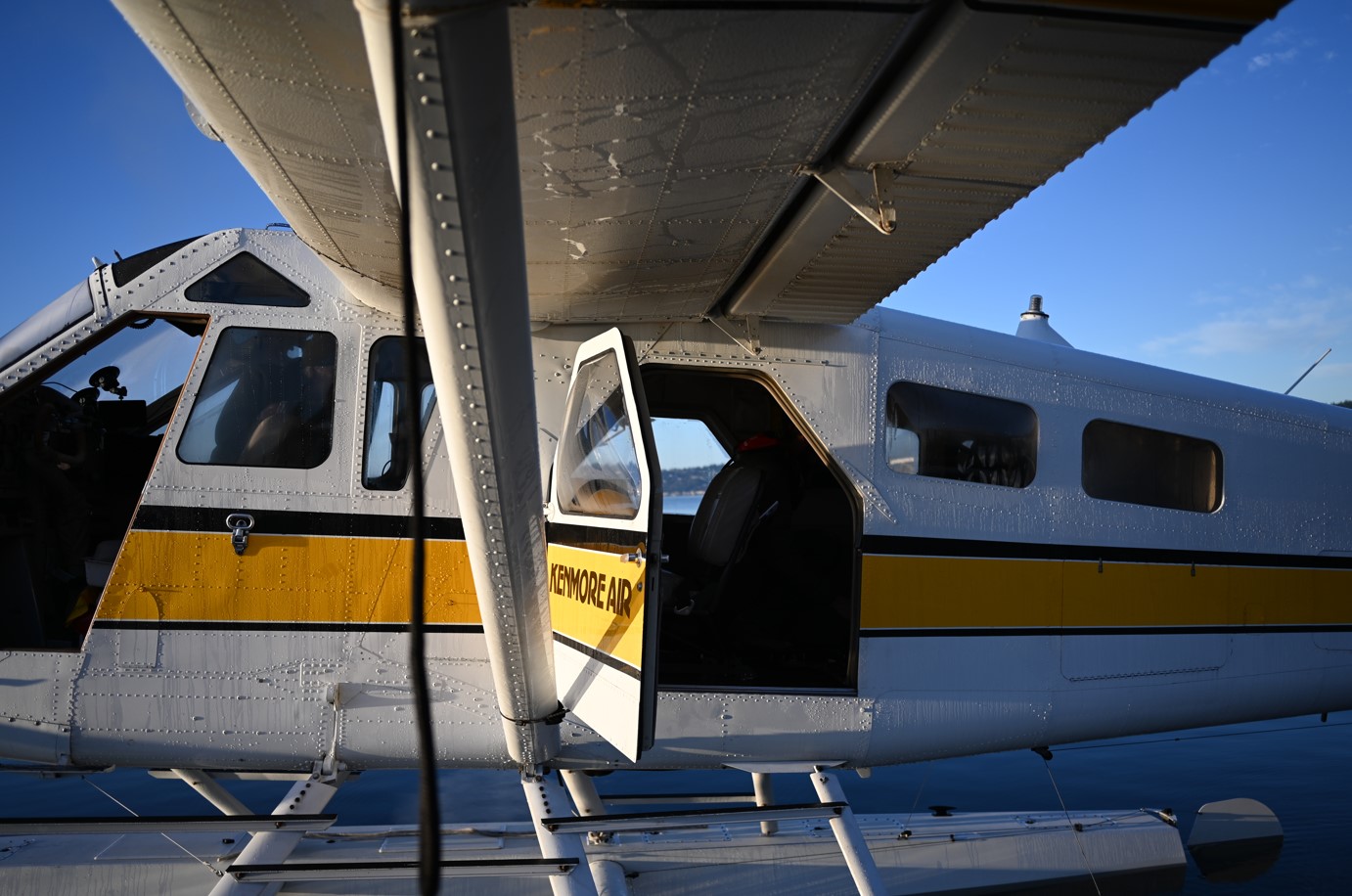
With traditional passenger seats in one of Kenmore’s seaplanes removed, digital cameras were mounted with a removable panel so that the DAS system captures imagery of the water below. Each image is precisely time-stamped and georeferenced, creating a permanent visual record of the survey area.
What once relied solely on human observation can now be reviewed, verified and re-analyzed allowing scientists to:
- Improve species identification accuracy
- Eliminate most uncertainty around species count and classification during surveys
- Revisit historical data as analytical tools evolve
- Expand survey coverage without increasing risk
The result is a richer, more resilient dataset, one that strengthens long-term conservation planning.
For Kenmore Air, supporting this effort meant more than flying a route. It meant working closely with biologists and engineers, modifying an aircraft to accommodate specialized equipment and ensuring flight operations met the exacting requirements of scientific data collection.


Flying Low, Flying Steady, Flying Right
From the cockpit, these survey flights look very different from a typical Kenmore Air operation.
There are no schedules driven by passenger demand. No scenic detours. No margin for improvisation. Instead, pilots fly precise transects at consistent altitude and speed, sometimes for hours at a time, while maintaining a stable platform for imaging and observation.
This kind of flying draws on the same skills Kenmore pilots use every day from reading wind and water conditions to managing aircraft performance with care and of course, prioritizing safety above all else.
What the Data Reveals
The information gathered during these midwinter surveys feeds directly into WDFW’s Seabird Survey Web Map, a public tool that allows researchers, planners, and policymakers to explore bird abundance by species, year, basin and water depth.
The data helps answer critical questions:
- Where are seabirds most concentrated and why?
- How are populations changing over time?
- How do development, climate, and human activity affect marine ecosystems?
These insights guide decisions around wildlife management and harvest regulations, oil spill response planning, coastal and marine permitting, habitat protection and restoration efforts, and long-term ecosystem monitoring.
Stewardship as a Way of Operating
For Kenmore Air, flying these surveys isn’t a one-off project. It’s an extension of how the company sees its role in the Pacific Northwest.
The waterways that serve as Kenmore’s runways are the same waters that support marine birds, fisheries, tribal communities and coastal livelihoods. Caring for them isn’t separate from the business, it’s inseparable from it.
Supporting programs like the Midwinter Aerial Seabird Survey reflects a simple belief – access comes with responsibility.
Looking Ahead
As technology continues to evolve, so too will the ways scientists monitor and protect marine ecosystems. Kenmore Air is proud to support that evolution, bringing together aviation experience and modern tools in service of something bigger than flight.
When a Kenmore aircraft lifts off on a winter morning with no passengers onboard, it’s easy to miss the significance. But those quiet flights carry purpose: helping ensure that the Salish Sea, and the life it supports remains healthy for generations to come.
It’s not the most visible work Kenmore does, but it may be some of the most important in sustaining the region’s ecosystem.


